
I rode my bike up and down the Padilla Bay Trail (PBT) today. It was a beautiful sunny summer day.
The trail is located near the intersection of Washington State Highway 20 & La Conner/ Bayview-Edison Road about 10 miles west of Highway 5. There are signs along Hwy 20.
Below are some maps and photos that I took today.
PBT is a very easy hike or bike ride. There are no kills to climb on the trail. You will find people of all ages, people walking their dogs, and bike riders of all types. Most people should be able to go in both directions in 90 to 120 minutes assuming no health issues. There are benches along the trail every 1/4 mile or so.
Hikers should remember to bring some water because there is none to be had along the trail.
I am sure that you will enjoy your high on the Padilla Bay Trail.

Padilla Bay Trail is just north of the intersection of Washington State Hwy 20 & Bowman-Edison Road.

There are parking lots at both ends of the trail. There are also bathroom facilities by the parking lots.

Parking at the north end of PBT is just off Bayview-Edison Road to the right. It is about 100 yards past the trail head.

The north PBT trail head is just on the south side of Bayview-Edison Road.

Heading south on the PBT just after entering the north side of the trail.

The 2 and 1/8 mile marker means that you have reached the south end of the PBT. It is just prior to the south parking lot.

PBT south parking is located just west of Bayview-Edison Road.a

The zero mile marker on PBT heading north just after leaving the south parking lot.

Heading north of PBT after passing mile marker zero.

Little Indian Slough is on the left side of PBT for most of the first mile while heading north.

This is the only building heading north on PBT a little before the one mile marker.

Little Indian Slough at low tide. It runs on the the left side of PBT for most of the first mile.

Little Indian Slough enters Padilla Bay about a mile north of the south end of PBT. In the distance you can see Cap Sante Rock overlooking Anacortes.

Mount Erie just north of Deception Pass can be seen from most of the PBT on a clear day.

Mount Baker can been seen to the northeast from most of the PBT on a clear day.

Other Cascade Range mountains can be seen to the east on most clear days from almost anyplace on the PBT.

Mile marker one heading north on the PBT.

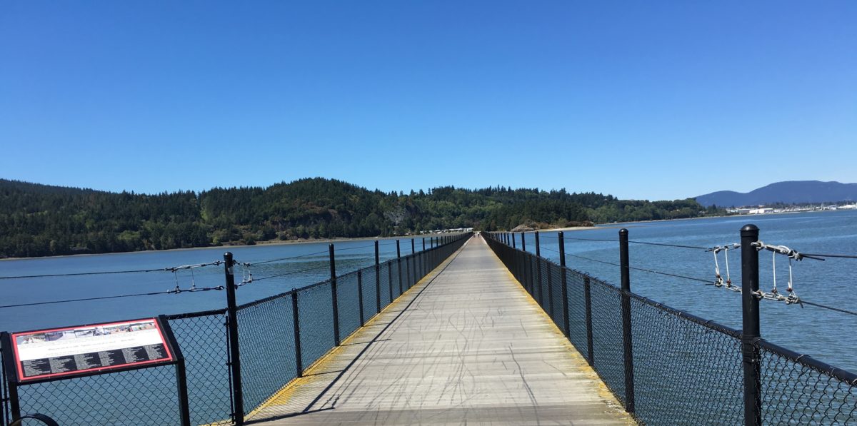
Heading north on the PBT.

The last marker at the north end of the PBT.
